I'm on a bit of a break from blogging. Apologies to anybody who's been checking here multiple times hoping for something new.
Not much has changed since my last post, and that's the main reason I decided to give the blog a rest for a while. The truth is that I was tired of writing essentially the same thing over and over. Soon I'll post an update of what's been happening with my aches and pains and my efforts to keep some kind of exercise going until I find the motivation for pursuing paddling excellence once more.
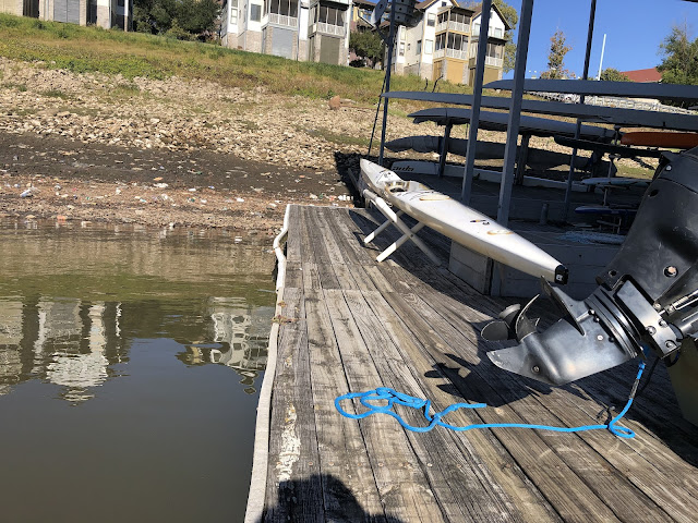
The main reason for this post is to share some photos I took today in the harbor. Yesterday the Mississippi River dropped to its lowest level ever recorded at Memphis. The record low had been -10.70 feet on the Memphis gauge back in the summer of 1988, and yesterday afternoon the water dipped almost a tenth of a foot lower than that: -10.77 feet.
By the time I got down to the river this morning it had risen back to -10.65 feet... still all but the record low, as far as I'm concerned. As I walked down to the marina, I found that the entire west end of it was in the mud:
Farther south, down the hill from River Garden Park where the Outdoors, Inc., Canoe and Kayak Race used to finish, an historic relic has been revealed. Pictured here is some kind of old wooden boat complete with the engine block that I presume once propelled it. I am not the first person to spot it: there's an orange traffic cone marking the site just to the right of this photo. I hope that means our local archeologists are on it:
There are two marinas in the harbor. I've shared pictures above of the one where I keep my boat. The other one is some one thousand meters to the south, and it's not faring so well right now, either. The entire west wing and much of the east wing are sitting in the mud. The boats in this photo won't be going anywhere until the water comes up a few feet:


No comments:
Post a Comment